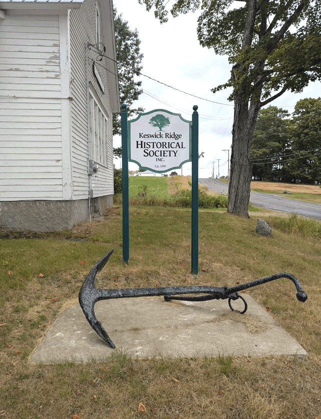
The Admiralty Anchor
This is another one of those items that causes people to stop and puzzle for a minute. An anchor? That big? Up here? And to be honest, between it, and the cannon mounted around the corner, visitors can be forgiven for assuming that Keswick Ridge was settled by pirates.
The truth is, anchors can be an amazing way to date various activities, particularly when you live in the Maritimes, and right along what’s been called the “Rhine of North America.” So when Gord Yamazaki, Project Manager of the Mactaquac Ecosystem Study and his crew at the Canadian Rivers Institute hauled this specimen up during a routine survey off of Crocks Point in 2018, we were more than happy to accept it as a donation.
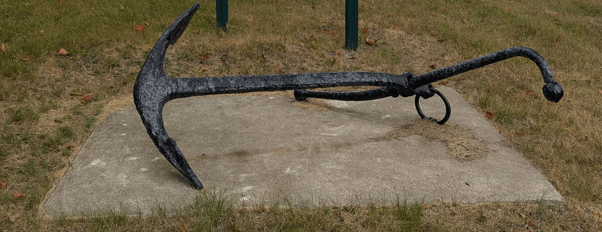
So what was it doing there? The anchor, devoid of a foundry mark or identifier is, according a shipwreck specialist from Florida that Gord spoke to, a “Folding Stock Yachtsman Anchor” which is a type of “Admiralty Anchor.” An enduring emblem of the age of discovery and conquest of the ocean - from the Spanish Armada to the British Navy (hence the name) - this was the basic anchor design from the late middle ages to the late 19th century. Which doesn’t help much with dating it. We do know that there weren’t any foundries in New Brunswick capable of making it during the general period it must have been left there. The best we can surmise is that it came here from Saint John, where most anchors like this were imported from English manufacturers.
So what can we speculate? Ideally, we’d tell you the legend of a rogue British gunboat and it’s treasonous captain being chased by the Royal Navy and running aground on the shoals at the bend in the river by Crock’s Point. The captain fled with his first mate into the Lunt family woods with a cauldron of gold coins (see our notes on the cannon) leaving the crew to shoot it out from the wreck to avoid being hanged. The fact is, though, that there is no such legend (there should be) but there are a couple of fairly reasonable, but rather more innocuous explanations, both of which are supported by local memories.
Before the completion of the Mactaquac Dam in 1966, there had been a ferry that ran across the river at Crock’s Point (one of which, “Lunt’s Ferry” we have records and photos of) and it would have begun as a free-floating, oared boat, but switched to a cable system around 1825 (there are still eight operational cable ferries on the river). These ferries often employed an “emergency” anchor in case the cable broke, and we can assume that this anchor may have been used that way, any time up to and including the horse-powered Lunt Ferry’s time (beginning in 1870) and before 1966. According to one expert, this anchor’s size is congruent with the dimensions of a river ferry, so this tracks.
But fairly reliable local sources also talk about anchors such as this being used to hold log booms as they made there way down river to various mills, a two-century-long industry that saw it’s peak in the 1860’s, but with large annual log drives still frequent until the 1970’s.
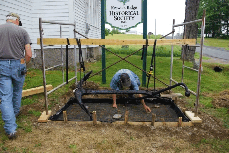
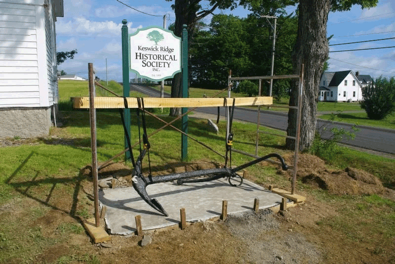
Either way, it looks smashing under our sign, thanks to the indominable Dan Nicholson and a crew of volunteers, and the investigation continues.
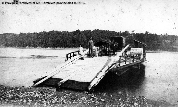
Lunt’s ferry, at Crock's Point circa 1900. Built around 1870 by Enoch Lunt, that's his daughter Mable (seated). The cable ferry was powered by a horse team (in this photo, "Dan" and "Jenny").

Gord Yamazaki, Canadian Rivers Institute Project Manager for the Mactaquac Ecosystem Study, with his "catch."
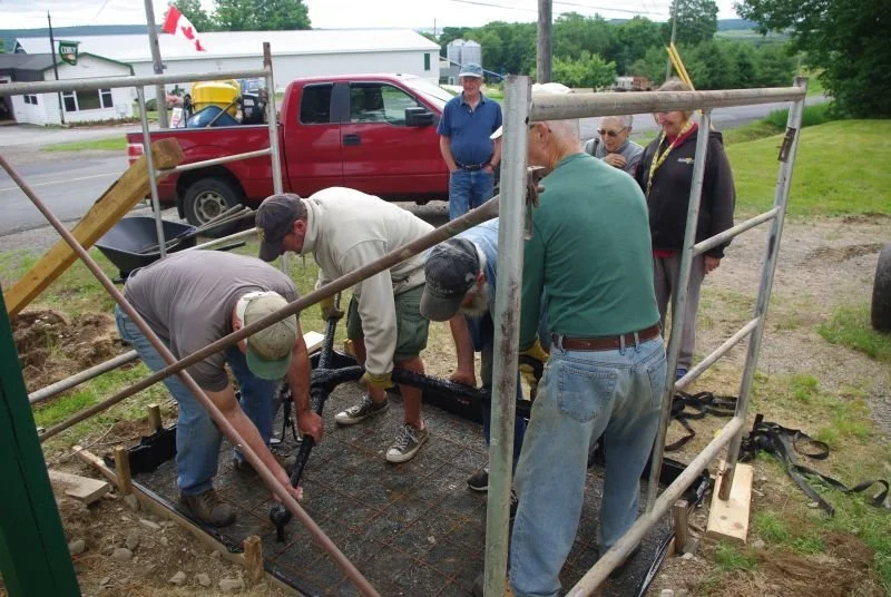
How many KRHS members does it take to install an anchor?